Welcome to Floodplain Management
Floodplain Management is the operation of community program of preventive and corrective measures to
reduce the risk of current and future flooding, resulting in a more resilient community. Greenville
County participates in the National Flood Insurance Program (NFIP) - Community Rating System, which
affords Greenville County residence a 15% discount on their flood insurance policy.
- Flooding Risk is Real - Anywhere it rains, it can flood.
- Know Your Risk - To reduce your flood risk, you need to know
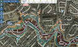
your level of risk. Click on the map below to check your property's flood risk.
- Reduce Your Risk - Once you have learned your level of flood risk, you
can work with your Floodplain Administrator to identify actions to reduce those risks.
- Insure Your Risk - Another way to reduce flooding impacts is to purchase
flood insurance through the NFIP.
Are You Living In a Floodplain?

Greenville County is pleased to announce that the 2021 FEMA Flood Insurance Rate Maps are now
available to view using the County's GIS system. To see the 2021 flood zones, base flood
elevations, and Letters of Map Amendments (LOMA), click here. LOMAs are also available
in our office at 301 University Ridge, Suite S-3100, Greenville, SC 29601.
Important Announcement
Greenville County Rainfall Data click here, please check the legend for additional information.
Greenville County Flood Monitoring Network click here, please check the legend for additional information.
FEMA Recognizes Greenville County for their Best Practice Mitigation Program for a Second Time